South Africa » Port St Johns Open Africa Route

Download GPS Coordinates (KML file) (what is this?)

Port St Johns Open Africa Route

Route rationale:

The New Partnership for Africa’s Development’s (Nepad) core group is concerned that disadvantaged communities in South Africa are not benefiting from tourism, which is one of the fastest growing economic sectors worldwide. OR Tambo district municipality, situated in the Eastern Cape Province has been selected as one of the presidential nodal areas for development in the country. It means this area is the focus of special attention as far as upliftment is concerned.  

The route was initially designed to cover the whole of the OR Tambo district municipality, but this area is so large that it was decided to focus just on Port St Johns. Therefore the route involves the Pondo people in the rural villages of the Wild Coast (Port St Johns), the nature reserves and the many private lodges in the surrounding vicinity. This forges links between established tourism operators and the surrounding communities. The Port St Johns Open Africa Route seeks to maximise the tourism potential of the region to the benefit of all its inhabitants, by eventually providing a continuous network of Afrikatourism attractions within the OR Tambo district municipality.

The route combines already well-developed and sophisticated establishments alongside previously untapped attractions. Tourists have the opportunity to learn about the Pondo people, their history, culture and customs.

The Pondo People:

Tourism is about meeting people, learning about them and their culture and the environment in which they live. The Xhosas know Port St Johns as uMzimvubu “the place of the hippo”. The uMzimvubu River gorge has two towering headlands of sandstone cliffs, rising 360m above the sea forming the Gate of Port St Johns.

The Pondo people live in the uMzimvubu region and have a rich and colourful heritage. Their traditional clothing was often dyed red using red ochre and the way each person dressed indicated their clan and their societal status. The beadwork, that is still prevalent, has different patterns and styles for different occasions and uses.

Married Xhosa women smoke long stemmed pipes, which prevents ash from falling onto her breasts or a child on her lap. Men smoke shorter pipes and both pipes are decorated with intricate beadwork.

Exquisite beadwork, baskets, traditional clay pots, clay models, handcrafts and wooden carvings are very popular with visitors to the region and are sold by the local people alongside roads and through formal retail outlets.

The Pondo people have traditionally lived in rondavel huts, built with their doors facing east. The rondavels are constructed with natural materials including cow dung and clay for the floor, wood from indigenous trees for the framework and roof beams and sturdy thatching grass for the roof.

These traditional homes and their unique design ensure that they are cool and comfortable in summer and retain warmth in winter. During strong gale force storms the huts remain standing and secure while many western-style structures are often destroyed.

Route Location:

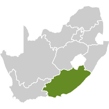
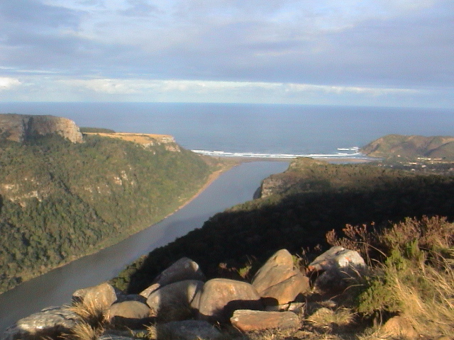
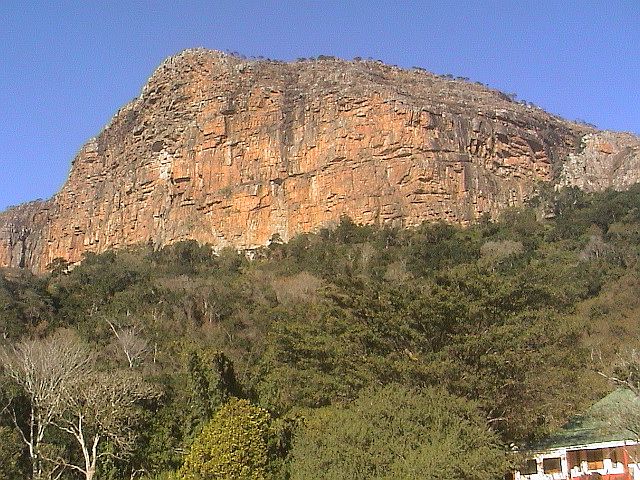
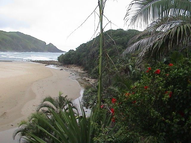
The Port St Johns Open Africa Route is situated 31º south and 29º east, at the mouth of the Umzimvubu River in the southeast part of South Africa in the Eastern Cape province (in an area that was previously known as the Transkei homeland). It is situated about 100km east of Umtata (where the N2 national highway is located).

History of Port St Johns:

Port St Johns was named after the Sao Joan ship wrecked there in 1552. Prior to that the Mthwa people, under the warrior son of King Faku of Mpondoland, inhabited this area.

A turning point in the history of Port St Johns occurred in 1845 when Ndamase crossed the Umzimvubu River on a bundle of sticks (iinyanda). Ndamase was greeted by Fono, one of the Mthwa chiefs, and thereafter western Mpondoland became known as Nyandeni after the famous bundle of sticks (iinyanda) At the same time a small colony of white traders settled at the mouth of the Umzimvubu River, where Rosebud was the first known vessel to hazard a passage across the sand bar at the mouth of the river (which was notorious for wrecking ships) and open a harbour for trade. The captain believed the area was ideal for stopovers and to serve as a trading post. Some other ships followed and notwithstanding several wrecks, the river mouth became accepted as a port of call for coasters conveying goods for trade with the Pondo and other local people.

With the name Port St Johns then established, the British government decided that it was essential to effect control over the area, especially in view of the possibility of foreign powers landing there and the threat of the region being used by gunrunners. In 1878 the British government ceded the western bank of Umzimvubu to Chief Nqwiliso, who ruled over the independent Pondo people.

In 1884 Port St Johns was formally annexed by the Cape Colony and was governed as a white enclave apart from the Transkei territories. Small ships would land with cargo of whisky, beads, blankets and trade goods. They took away maize, ivory, hides and other products of the Pondos.

In 1930 the celebrated wandering hippopotamus, Huberta, arrived in the village and resided there for six months, which was when the river became known as Umzimvubu (home of the hippopotamus). Huberta had started her journey in Zululand in 1928, progressing via Durban down the coast she travelled nearly 1600km to King William’s Town. She gained great fame along the way, until she was accidentally shot by a farmer.

In 1935 Port St Johns became a municipality and its sea trading days ended in 1944. In 1963 when the Transkei government was formed, Port St Johns was explicitly excluded until 1976 when 'homeland independence' was granted and Port St Johns was handed over to Transkei.

Tourism and Recreational Activities:

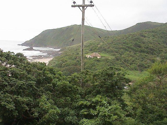
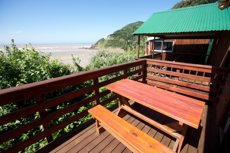
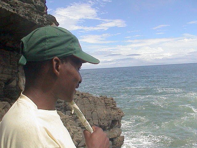
Port St Johns has numerous estuaries, bays and headlands. Rocky shores predominate and precipitous cliffs drop dramatically into the sea. Small sandy bays and long stretches of open beach are also found here, often near the mouth of large rivers like the Umzimvubu River and Umngazana River. This coastline’s waters mark the transition between the temperate Cape and the subtropical KwaZulu-Natal. As a result a diverse array of fish and invertebrates occur here.

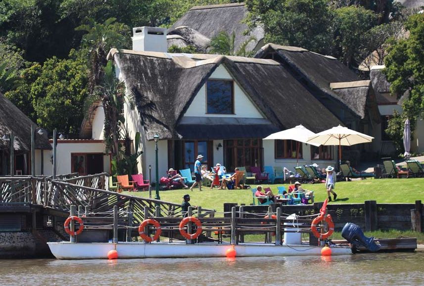
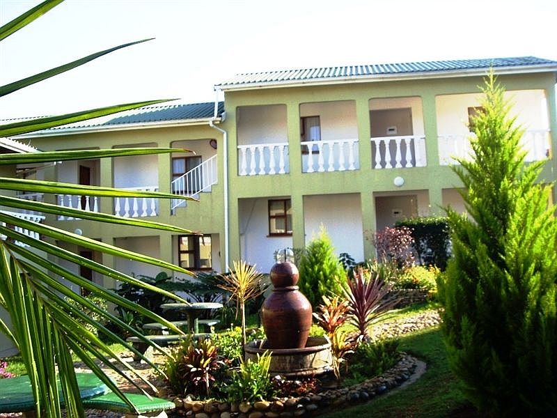
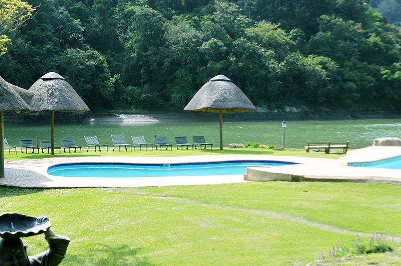
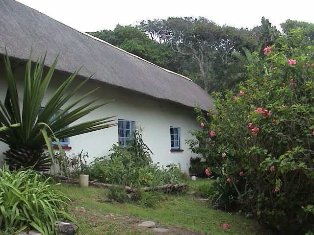
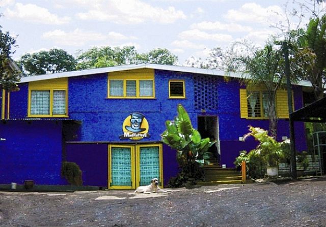
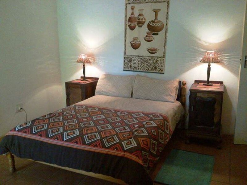
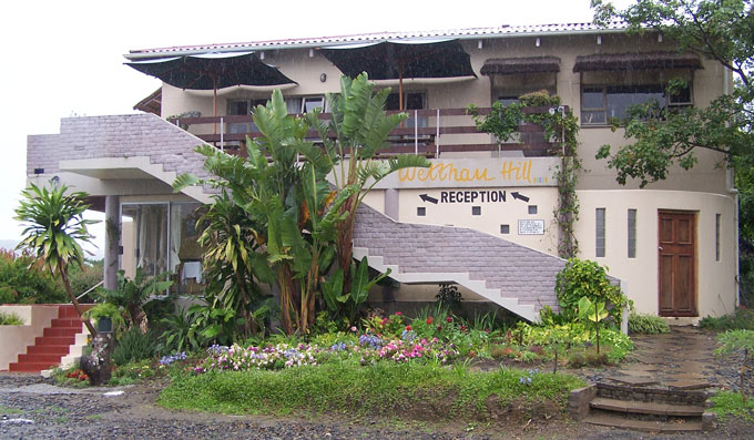
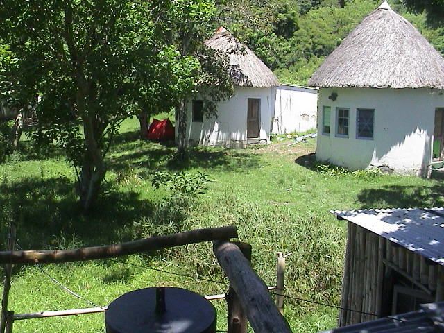
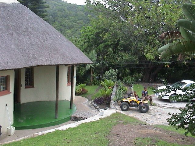
Port St Johns is dominated by rural subsistence activities and is largely under-developed because of limited economic activities and poor infrastructure. The region makes only a small contribution to the economy of the Eastern Cape as whole.

Poverty indices show that the people of Port St Johns are among the most impoverished in South Africa. Many depend on the sea for their subsistence, with line fish and inter-tide organisms providing an important source of protein for rural communities.

A wide variety of accommodation is available. This includes camping sites, bed and breakfast establishments, self-catering apartments and guesthouses of various grades. Some of the hiking trails are also very popular and need to be booked up to a year in advance.

Impact of Development and Tourism:

The beautiful scenery and natural resources of the Wild Coast are famous South African treasures. But without affective management the coast can be overused, degraded and developed to a point where the very features that attract tourists will be lost. It is therefore important to balance development and restrict access where necessary. It is also important that local communities realise the benefits of tourism. Tour companies from foreign regions should also be encouraged to use local tour guides, amenities and produce and goods.

Places of Interest:

Gap and the blow hole:

Found at Second Beach just below Mthumbane Village, this dolerite formation in folded sand stone is quite spectacular. When a strong south–westerly sea is running, the blowhole sends up large clouds of spray, sometimes many, many metres high. Make your way down the hill from the end of Mthumbane and use the cable to climb down into an enclosed gully. Follow the ridge and then climb down the ladder from where you can see the blowhole.

This place is interesting but dangerous, so don’t take chances and rather have a guide accompany you. It is best to visit on clear, windless days and you are advised not to attempt this trip when it is raining or if there is a strong wind blowing. If you are afraid of heights this trail is not for you.

Mt Thesiger (the air-strip):

Visit the air-strip (that caters for small planes) from where there is a beautiful view of the Umzimvubu River and the town.

Lighthouse (first beach):

Installed in September 1904, it reaches a height of 55m. A walk to the lighthouse is an adventure and a very pleasant way to experience a wide spectrum of life in Port St Johns. You can drive to the lighthouse, but make an appointment through the Port St Johns tourism centre.

The National Museum, overlooking the golf course:

It is a five-minute drive to the national museum, where you can learn much about the Pondo people and their culture.

Silaka Nature Reserve offers:

  • Walking trails;
  • Rock Art;
  • Bird-watching;
  • Fishing; and
  • Education tours.

Isinuka Sulphur Springs:

These springs have long been regarded as a place of healing and are still very much in use today. Traditionally the sulphur water is used to cure stomach and skin ailments.

Situated in dense forest, the springs are made up of several healing areas. Drive to the spring situated about 10km out of Port St Johns along the road to Umtata. Many people visit the Isinuka Spring and collect the sulphur-rich water for medicinal purposes. To reach the pure spring water, visitors climb the enormous rock side using a fig tree as a staircase.

Other places of interest or things to do:

  • Walk along Second Beach and visit Silaka Nature Reserve;
  • Immerse yourself in the sulphur springs;
  • Join a deep-sea charter;
  • Canoe and fly-fish;
  • Join a cultural tour;
  • Horse- and hiking trails;
  • Browse craft markets; and
  • Take in a round of golf.

Nearby routes

Baviaanskloof Route

The Baviaanskloof Route encompasses the broader Baviaanskloof area, which contains a newly proclaimed World Heritage Site, and offers a mix of sights and activities relating to nature and culture.

eScape Route

This area has so much to offer and many stories to tell.  Stutterheim, at the heart of the area, has a very interesting political  past which allowed people to think that there was a way to deal with inequalities of the past.  We also have a range of adventure tourism and cultural attractions and a large amounts of arts and crafts all waiting to be discovered.

Garden Route Sea Kayaking Trails

These trails are situated along the famous Garden Route. The area offers warm-water sea paddling with its associated marine life, as well as many lakes and estuaries to explore.

Inyathi Buffalo Route

Buffalo City boasts a variety of tourist attractions and is rich in cultural and natural resources. The 68km coastline includes 10 estuaries, conservancies, natural heritage sites, rocky shores and 14 sandy beaches. There is a long-standing tradition of beadwork in the area.

Maloti Route

This route spans the borders between South Africa and the mountain kingdom of Lesotho, providing travellers with the opportunity to experience a diversity of cultures – Basotho, English, Xhosa and Afrikaans.

Mbodla Eco-Heritage Route

The Fish River (Nxuba) Valley is located adjacent to a thriving game-farming area of the Eastern Cape. The Mbodla Eco-heritage Route adds an original, Afro-centric, environmental, cultural and heritage dimension to the region’s offerings.

Mid-Karoo Route

This route is surrounded by dramatic mountains in the heart of the great Karoo and falls within the Nama Karoo Biome. This region is recognised for its herbal plant life, an exceptional variety of scarce birdlife and rock art from the San Bushmen. It is also one of the few, and best, places in the world where fossils are found.

Comments and Reviews

Add a comment