Mapungubwe Route

South Africa » Mapungubwe Route

Download GPS Coordinates (KML file) (what is this?)

Mapungubwe Route

The Mapungubwe Route lies west of Musina and stretches roughly to the Pontdrift border post. This is the route to the ancient Kingdom of Mapungubwe, South Africa’s first kingdom, which existed in the 13th century from about 1220 to 1290, on top of Mapungubwe Hill, the 'place of jackals'.

It is here where gold artefacts, including the Golden Rhino and other treasures have been discovered, revealing a sophisticated civilisation that was capable of working gold and traded with the Indian Ocean trade network that included the countries of Arabia, China, Indonesia and India. Mapungubwe was the forerunner of the Great Zimbabwe civilisation, and it is estimated that up to 5000 people lived around the area known as Mapungubwe hill.

The Mapungubwe Landscape was declared a World Heritage Site on July 3, 2003. This confirmed the international importance given to the area to ensure that the natural bio-diversity of fauna and flora and African Iron Age archaeological sites are preserved for future generations to learn about and enjoy.

However, the Mapungubwe Route is not only the road to the ancient kingdom. It is also the road to one of South Africa’s newest national parks, the Mapungubwe National Park that incorporates the World Heritage Site. The northern boundary of the park is the Limpopo river.

This once mighty river’s banks are still strewn about with giant fever trees, mashatu trees and huge sycamore fig trees. The viewpoint overlooking the confluence of the Shashe and Limpopo rivers is a vista where three countries, Zimbabwe, Botswana and South Africa, meet.

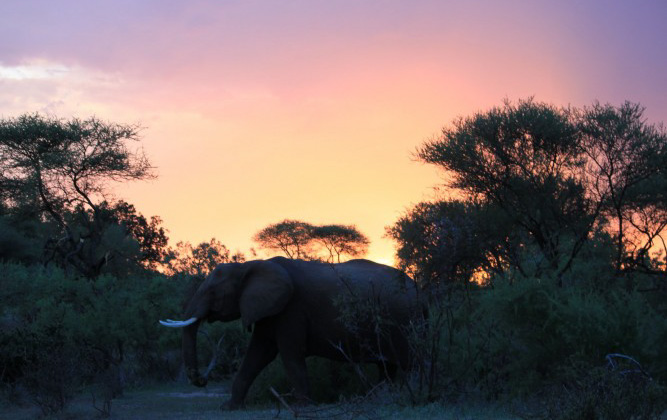
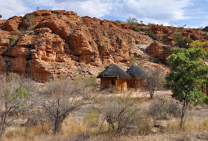
The area boasts an impressive landscape including sandstone cliffs, balancing rocks, riverine forests, Mopane bushveld and views of the Limpopo River. The landscape changes dramatically after suitable rain and supports many endemic species of plants and flowers. The boundaries of the Mapungubwe National Park will ultimately include about 28000 hectares.

The park will form the core of the proposed Limpopo-Shashe TransFrontier Conservation Area, incorporating parts of Zimbabwe, Botswana and South Africa. Wildlife at present includes elephant, giraffe, eland, gemsbok, blue wildebeest, red hartebeest, zebra, kudu, waterbuck, impala, bushbuck, klipspringer and other plains game. The park offers facilities for both overnight visitors and day visitors.

There are birding and game viewing hides, elevated tree-top walks to the Limpopo river, eco (4x4) trails and picnic sites. Guided visits led by SANParks guides are available to and up onto Mapungubwe Hill, and to San rock art and dinosaur fossils.

The Mapungubwe Route is an area with a great diversity of bird species. It is an area of crossover covering the most southerly latitude for the northern species while being the most northerly latitude for many of the southern species. It is also an area of crossover between the desert birds of the west and the tropical birds of the east. Many of the migrations pass over this area, and vagrants are frequently spotted. More than 400 bird species have been identified in the area. This area is also included in the Soutpansberg Limpopo Birding Route that was developed in conjunction with Birdlife SA.

The Mapungubwe Route also provides visitors the opportunity to see a crocodile farm, San rock art, wildlife, wilderness trails and even diamonds at the De Beers Venetia diamond mine.

Along the Mapungubwe Route the baobab tree (Adansonia digitata) is the undisputed king of the bush. These giant trees with their enormous girth and dominating presence are surrounded by legend, one of which explains the root-like branches by saying that the gods, in a frivolous mood, planted the tree upside down, exposing the roots.

There is a nature reserve that was established some years ago to preserve the baobabs in the area and over a hundred mature specimens can be seen. This small reserve also contains the world’s oldest exposed datable rock, a piece of granite gneiss with an estimated age of 3 852-million years. It is also a good place to see the impressive and majestic sable antelope.

A baobab trail wends its way amongst many baobabs, most over 1000 years old. Each of these baobabs has its own character and a name describing it. It is a one or two day walking trail, but it is also possible to follow the route on a mountain bike.

Scattered along the Mapungubwe Route, impressive Rock Figs grow out of huge rocks while some of their roots flow over the rock surface.

Nearby routes

Hlanganani Route

The Hlanganani route is situated in the northernmost part of South Africa, in Limpopo (previously known as Northern Province), on the north-west border of one of Africa’s finest parks, the Kruger National Park.

Kamoka Route

The region in which this route is located is known as the Cultural Heartland, which is one of the seven registered tourism regions of Mpumalanga province. The general route area is located about 100km north-east of Pretoria, South Africa’s capital city situated in Gauteng, which is the smallest but richest province in the country.

Kruger to Canyons Route

Located in the Kruger to Canyon Biosphere, this route includes the towns of Graskop, Hoedspruit and Phalaborwa. It aims to contribute to the conservation of the biosphere.

Land of Legend Route

The Land of Legend Route, true to its name, offers a platform to explore sacred lands, rippling rivers and awe-inspiring nature sites. Based in Thohoyandou, it is within close range of the Kruger National Park, but deserves more than a stop-over.

Ribolla Open Africa Route

The route, named after the uniquely shaped mountain in the Makhado District, showcases the artistic talents of many of its inhabitants, as well as dancers, storytellers, gardeners and singers.

Rixile Culture to Kruger Route

The route, situated in the Limpopo province of South Africa, meanders between the small town of Giyani and Phalaborwa, the only town with a gate into the Kruger National Park.

Route of Lost Kingdoms

Follow a trail of myths and legends from the ancient stone wall site of Thulamela to the Mapungubwe World Heritage site in Limpopo Province.

Seraki Blouberg Route

This route lies at the foothills of the Blouberg Mountain in Limpopo and offers an experience that can only be found in Africa. A range of projects with authentic arts and crafts, as well as accommodation in a pristine setting can be found. Vistors can go on adventurous hikes, see cultural and natural heritage and interact with 'real' people.

Comments and Reviews

Add a comment