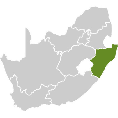
This is a route with a difference. In the South Durban Basin (as the area is known) there are five main residential suburbs: Bluff, Treasure Beach, Merebank, Austerville and Wentworth. Interspersed among the houses are a number of industries, including two of South Africa’s largest oil refineries, the Durban International Airport, a paper mill and other smaller factories. This mixture of residential homes and large industries creates a challenge for all those who live and work in the area. Air pollution, water pollution, overcrowding and litter are some of the problems that residents and industries work to resolve.
And yet the South Durban Basin area has some amazing tourist attractions – including pristine beaches, bird sanctuaries, a fascinating mix of cultures, and a unique history. The area also offers accommodation, restaurants, shopping centres and all the services a tourist could need (including medical and transport). Visitors to the area can ride horses along the beach, visit some of the factories, fish, take a tour through the region to learn the history, visit some of the local community projects such as a home for the disabled, or simply relax on the beach with a book.
The area is indeed a basin in that a large cliff called the Bluff, covered in tropical vegetation, rises from the beaches and then drops again steeply into a valley area. This valley stretches across the N2 national road until the land rises up into rolling hills again – forming a neat basin. Don’t miss the spectacular viewpoint that overlooks the Merebank community, with views all the way through to the airport.
The South Durban Basin area has an interesting history. Black, white, coloured and Indian people live here in many different kinds of accommodation – from large houses in the wealthier suburbs to barracks-type flats. The industries that developed in the area were seen as an asset as they provided local employment. However, with residents and factories cheek by jowl inevitable tensions arise, and this route is seen as a way to promote better relationships while engendering a feeling of pride in the area.
Recently, with the demise of apartheid and the start of environmental lobbying movements, the basin area has become more integrated. People of all races live together as a community, crime and gangsterism levels have decreased, and the community unites with one voice to ensure that the basin area is a healthy environment to live in, as well as a place that tourists love to visit. A recently reclaimed portion of land in the basin is now home to a community from Zanzibar.
Natural attractions:
Although the South Durban area is very built up, adjacent to it are the sea and pockets of pristine nature which are home to a variety of plants and animals, including about 100 bird species.
Much of the Bluff slopes is also pristine and two plants dominate here – the coast silver oak (Brachylaena discolor) and the wild banana (Strelitzia nicolai). Here one may also find the coastal red milkwood (Mimusops caffra) and the dragon tree (Dracaena aletriformis). At night, hawkmoths and other insects visit the latter to sip its nectar. The Bluff also has some alien invader species such as the Barbados gooseberry.
Monkeys, duiker, rodents, snakes, butterflies and bats abound in the forests, while whales and dolphins can be seen along the shoreline during migrations.
The Bluff:
As one of the main enclosing elements of the Bay of Natal, the Bluff headland has extraordinary geographical, environmental and historical significance. As a regional landmark, it is visible from great distances, both inland and from the sea, and it must have provided early travellers with an easily recognised reference. For the past 150 years it has been dominated by navigational and military usage. Fortunately, the latter ‘fortress‘ use has allowed many of the discrete ecological systems to survive. It also provides a long green backdrop to the city centre and is thus one of the major components of the Durban open space system. With water on three sides it also has the qualities of an island.
The traditional Zulu name for the Bluff is isibubulungu. There are two possible meanings: the first is a long, round-shaped ridge and the second is “the white man’s bluff” – a reference to the fact that it became the first refuge for white shipwreck survivors. Both are apt. The English word ‘bluff’ means a headland or cliff with perpendicular face.
The Bluff ridge is a remnant of an extensive coastal dune system that formed along the shoreline of KwaZulu-Natal between 2 million and 5 million years ago. At that time the KwaZulu-Natal shoreline was about 120m below its present level and at the edge of the continental shelf about 15km seaward. At the end of the last ice age, between 10 000 and 18 000 years ago, the sea level rose to about its present position.
The area now boasts some of the world’s most diverse marine life. This colourful and unique ecosystem makes the Bluff a popular destination for snorkelling and educational visits.
History of the South Durban Basin:
The Bluff area was originally a predominantly white area where mostly blue-collar government workers lived in government-issue houses. After the Group Areas Act came into being, people of other races were forcibly relocated into the South Basin.
Coloured families (who had previously lived in Cato Manor in the north of Durban) were told to relocate because their area was now declared ‘white‘. The coloureds were moved to Wentworth and housed in what were previously army barracks. It was extremely difficult for families who had previously had their own houses to suddenly live communally – even bathroom facilities were shared. The government however did try to help the coloured people in that they were encouraged to be educated (although this was seen as quite patronising). Eventually housing was built in the Merebank area and some families could afford their own apartments.
For the poorer people, it was difficult to afford housing and so a shanty-town formed, called The 88s. People also continued to live in the barracks (which was originally intended to be a temporary solution) and that was dubbed Rainbow Chicken Barracks because the people felt they were housed like battery hens. The Group Areas Act also moved Indian families to Merebank from certain parts of the Bluff and Cato Manor, and many families settled in a different part of the Bluff, just above Treasure Beach.
During the Sasol boom, the area struggled under a migrant labour system whereby the men moved to Gauteng to work at Sasol. This took men away from their homes for weeks at a time and contributed to many social problems. Gangsterism was rife as fathers were absent.
Industry, when it first arrived in the area, was seen as a solution to this migrant labour problem. The industries provided many local jobs and some of the social problems in the community declined. Then one of the residents studied environmental issues and mobilised the community to take action against the industries and to lobby for cleaner air.
Today, there are many mixed families in the South Basin area. The result is a fascinating community that has a sense of pride in their history and their mixed cultures.
A number of community organisations have been established to uplift the community.