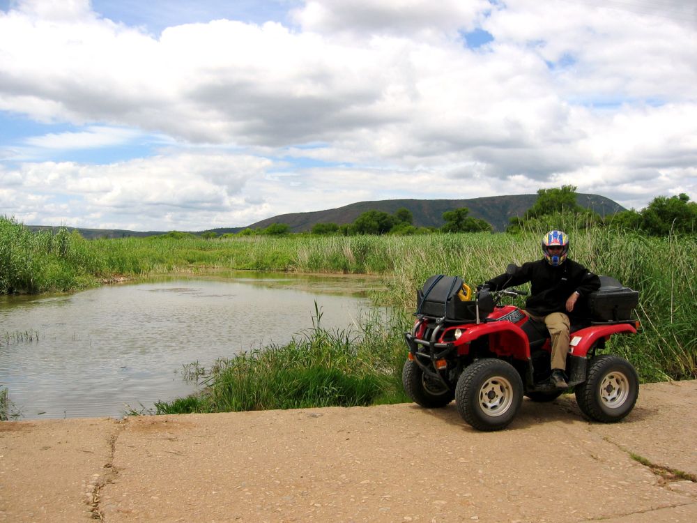
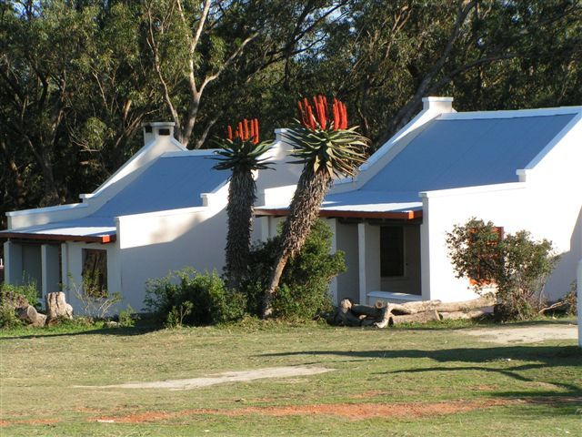
Coastal Gateway Route
The Coastal Gateway to the Baviaanskloof was developed so that visitors will be able to make the most of the south-eastern coast’s sun, sea and sand, as well as enjoying the interesting history of these coastal towns, before embarking a journey inland to the Baviaanskloof Mega-Reserve.
This gives travellers the chance to see and experience the diversity in nature, landscape, culture and lifestyles that South Africa has to offer. The route stretches along the eastern coast and includes the larger Bay of St Francis, which consists of the villages of St Francis Bay, Cape St Francis and Port St Francis. It also links to Jeffreys Bay, Paradise Beach, Aston Bay, Oyster Bay and the rural town of Humansdorp. Each town or village offers its own unique character and is worth visiting. The natural setting of this coastal gateway is the Cape Floral Kingdom, which provides ample opportunities for birding. The route’s diversity provides something of interest for everyone.
The Story Behind The Bay of St Francis:
St Francis is divided into 'The Cape', 'The Bay' and 'The Port'.
The name St Francis was chosen in honour of the patron saint of sailors (St Francis), by a Portuguese sailor who sighted this coastal stretch in 1575.
Many years later, in 1954, Leighton Hulett bought a piece of land in the fishing village that was then St Francis. He had a vision that he should add a marina and so he set about building a man-made canal system. Strict building codes were laid down, still relevant today. This developed into the village of St Francis Bay or 'The Bay'.
Soon development in the areas of Santereme and St Francis on Sea followed. This introduced a new look based on Mediterranean-style architecture.
In 1995 a commercial harbour and facilities were built at Port St Francis. This harbour serves as an important operations point for chokka (calamari) and long-line fishing industries.
Further along the coastline is a nature reserve which leads to Cape St Francis (The Cape). Here a lighthouse exists that was built in 1878 in order to warn ships and vessels of the treacherous reef surrounding the point. The lighthouse is 27.5m high and is the tallest masonry tower on the South African coast. Today it is a national monument.
To read more about each section of St Francis, look under each Cape St Francis and St Francis Bay.
Information received from St Francis Tourism. Contact them at +27 42 294 0076 or visit their website www.stfrancistourism.co.za for more information.
The Cape Floral Kingdom and St Francis:
South Africa has extremely diverse plant and animal life. In order to be able to grasp and analyse this richness, scientists have classified the different kinds of vegetation across the country. The south-western Cape region is classified as the Cape Floral Kingdom, which stretches from Port Elizabeth to Cape Town and inland, covering about 90 000km². This region is recognised as being especially rich in plant species and is identified as one of only six plant or floral kingdoms in the world. The region is the habitat for 9 000 plant species, of which 70% are unique to South Africa and this region, in other words they grow nowhere else in the world!
The 9 000 plant species are not distributed randomly however, but are found in different areas, where different kinds of plants grow together, almost like plant communities. This means that the whole region can be divided into specific vegetation types, comprising plant species that grow in their particular area and nowhere else.
The vegetation type that is located within the St Francis region, is St Francis fynbos/thicket mosaic. This type of vegetation only grows on lime-rich coastal sandy sites and is spread between the eastern Tsitsikamma in the west and Port Elizabeth (Cape Recife) in the east. Land that has suitable conditions for this type of vegetation stretches across a small portion of about 25 924 hectares, which makes up only 0.2% of the Cape Floral Kingdom. Since the time Europeans began settling in the area, disturbance and damage has been caused by urbanisation, agriculture, forestry and alien plant invasions. Consequently, these impacts from the past, as well as future threats of continued destruction by alien plants and the expansion of coastal towns and resorts, have been scientifically proven to place this vegetation under threat. It has therefore been classified as “critically endangered” which means that it is protected in terms of national legislation.
Preservation of the St Francis fynbos/thicket mosaic has been identified by scientists as a national conservation priority, because of its inherent richness, its relatively small coverage and the degree to which it has already been destroyed, along with the future threats it faces.
Visit the nature reserves in St Francis in order to find out more about this vegetation, to view its unique plant species and to support its protection.
Information supplied by FOSTER – Friends of St Francis Nature Areas. For more in depth information, latest news and projects visit their website at www.foster.org.za
Birding in the Coastal Gateway:
St Francis is situated in the Eastern Cape transition zone, placing it between winter- and summer-rainfall regions. It is also here where five plant biomes meet, which has resulted in a concentration of species in various habitats, where 80 of the 160 common species can be expected during only a few hours of birding. There is also a slight chance that birders could spot vagrants and less-common species, which provides for an exciting birding experience.
Special birds that can be sighted include the following:
- African fish eagle;
- Osprey;
- Cape gannet;
- African black oystercatcher;
- Goliath heron;
- African spoonbill;
- Black-winged stilt;
- Blue crane;
- Denham’s bustard;
- Olive bush-shrike;
- Southern tchagra;
- Cape longclaw;
- Cape grassbird;
- Five kingfisher;
- Three sunbird; and
- African stonechat.
Facilities in the area:
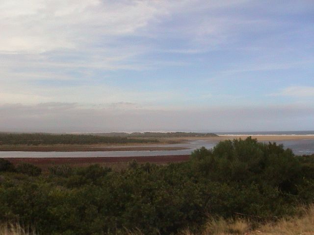
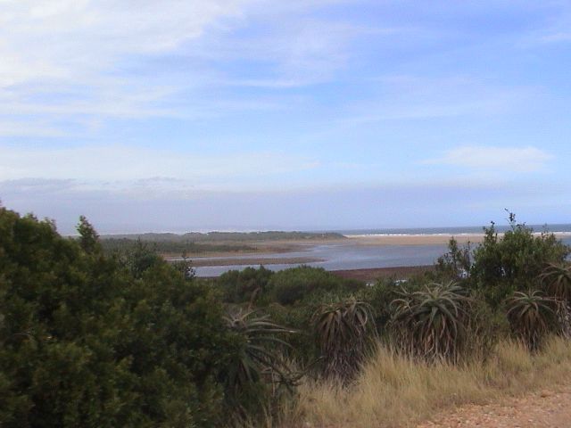
A good spot for birding is along the Kromme River estuary, which is easily accessible from the N2 via Humansdorp. There are trails along the coast which link the two villages of St Francis Bay and Cape St Francis, with pathways that cross through the Irma Booysen Floral Reserve.
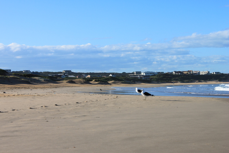
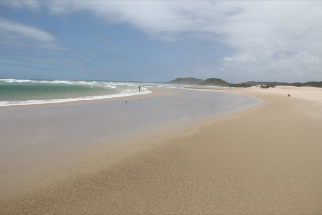
The sandbanks in the Kromme estuary, between the two inlets to the canal system, are also a good spot, as are the mud banks below the Kromme Bridge. Other spots can be found on the riverine and coastal bush, the community garden in Harbour Road, the village roadside and within the village of St Francis Bay. There are also several nature reserves, like Cape St Francis and Seal Point, the Irma Booysen Floral Reserve, and the farmlands and grassland areas.
Pelagic bird species such as the albatross and petrel also occur in the area, but can mostly be seen further out to sea. Boats are available to take birders out to sea in order to observe these species. St Francis Tourism is able to provide more details on this option, as well as a list of birds that occur in the area (Craig, 2001).
Contact them at Tel: +27 42 294 0076 or view their website: www.stfrancistourism.co.za. They are also listed as participants under St Francis Bay.
Information found on www.sabirding.co.za/birdspot/021324.asp , an article by Yvonne Craig, 2001.
CAPE ST FRANCIS:
The History of Cape St Francis (The Cape):
Cape St Francis is located approximately 22km from Humansdorp. Baviaanskloof is about a 45-minute drive from Cape St Francis en-route to George or Oudtshoorn.
Cape St Francis came about when man called John Booysen swapped his Chevrolet car for part of a farm that bordered the lighthouse at Seal Point. He then built a road that linked the lighthouse to the road that Leighton Hulett (responsible for the development at St Francis Bay) had built across the Sand River. Consequently one could drive from Hulett’s farm Goedgeloof, all the way to the lighthouse.
In 1963 Mr Booysen established the Kaap St Francis Vuurtoringmaatskappy (Cape St Francis Lighthouse Company). This private company was established to develop a township at Seal Point. Two years later, in 1965, this township was proclaimed Cape St Francis.
Things to do in Cape St Francis:
Cape St Francis consists of a holiday resort, a mini-market, restaurants and pubs. It also has a world-class surf reef and point break. It is situated in the small hamlet of St Francis and is a popular holiday destination, especially due to its beautiful stretch of beaches, extending from Seal Point to Shark Point. Seal Point is reputed to be one of the most famous surfing spots. The film The Endless Summer features Bruce’s Beauties, a surfing spot just around the Cape St Francis point.
Activities do not end at water sports however, as there are a number of nature reserves in and around Cape St Francis. These include the Irma Booysen Nature Reserve, Seal Point Nature Reserve, Seal Bay Nature Reserve and Cape St Francis Nature Reserve. The coastal fynbos flowers in August, making this an optimal time to visit these nature reserves. The Sand River also has underlying secrets as it transports about 80 000 cubic meters of sand from Oyster Bay to St Francis Bay annually.
Activities like hiking, birding and a range of water sports provide opportunities to pursue a wide variety of interests.
Nearby routes
Baviaanskloof Route
The Baviaanskloof Route encompasses the broader Baviaanskloof area, which contains a newly proclaimed World Heritage Site, and offers a mix of sights and activities relating to nature and culture.
eScape Route
Garden Route Sea Kayaking Trails
These trails are situated along the famous Garden Route. The area offers warm-water sea paddling with its associated marine life, as well as many lakes and estuaries to explore.
Inyathi Buffalo Route
Buffalo City boasts a variety of tourist attractions and is rich in cultural and natural resources. The 68km coastline includes 10 estuaries, conservancies, natural heritage sites, rocky shores and 14 sandy beaches. There is a long-standing tradition of beadwork in the area.
Maloti Route
This route spans the borders between South Africa and the mountain kingdom of Lesotho, providing travellers with the opportunity to experience a diversity of cultures – Basotho, English, Xhosa and Afrikaans.
Mbodla Eco-Heritage Route
The Fish River (Nxuba) Valley is located adjacent to a thriving game-farming area of the Eastern Cape. The Mbodla Eco-heritage Route adds an original, Afro-centric, environmental, cultural and heritage dimension to the region’s offerings.
Mid-Karoo Route
This route is surrounded by dramatic mountains in the heart of the great Karoo and falls within the Nama Karoo Biome. This region is recognised for its herbal plant life, an exceptional variety of scarce birdlife and rock art from the San Bushmen. It is also one of the few, and best, places in the world where fossils are found.
Port St Johns Open Africa Route
En-route from Durban to Buffalo City, Port St Johns has numerous estuaries, bays and headlands. Small sandy bays and long stretches of open beach are found here, often near the mouth of large rivers like Umzimvubu River and Umngazana.


Comments and Reviews
Add a comment
See all comments about this route